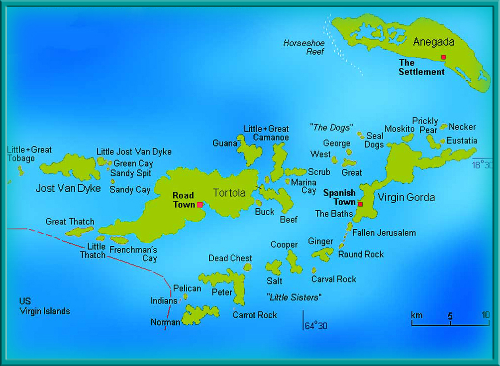
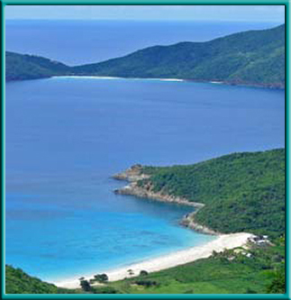
THE BRITISH VIRGIN ISLANDS
APRIL 7-18, 2013
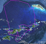
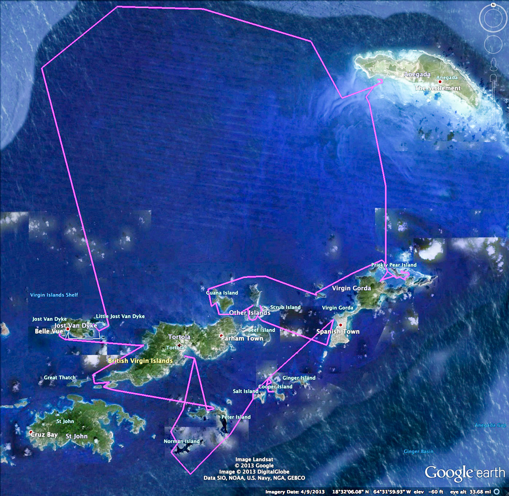
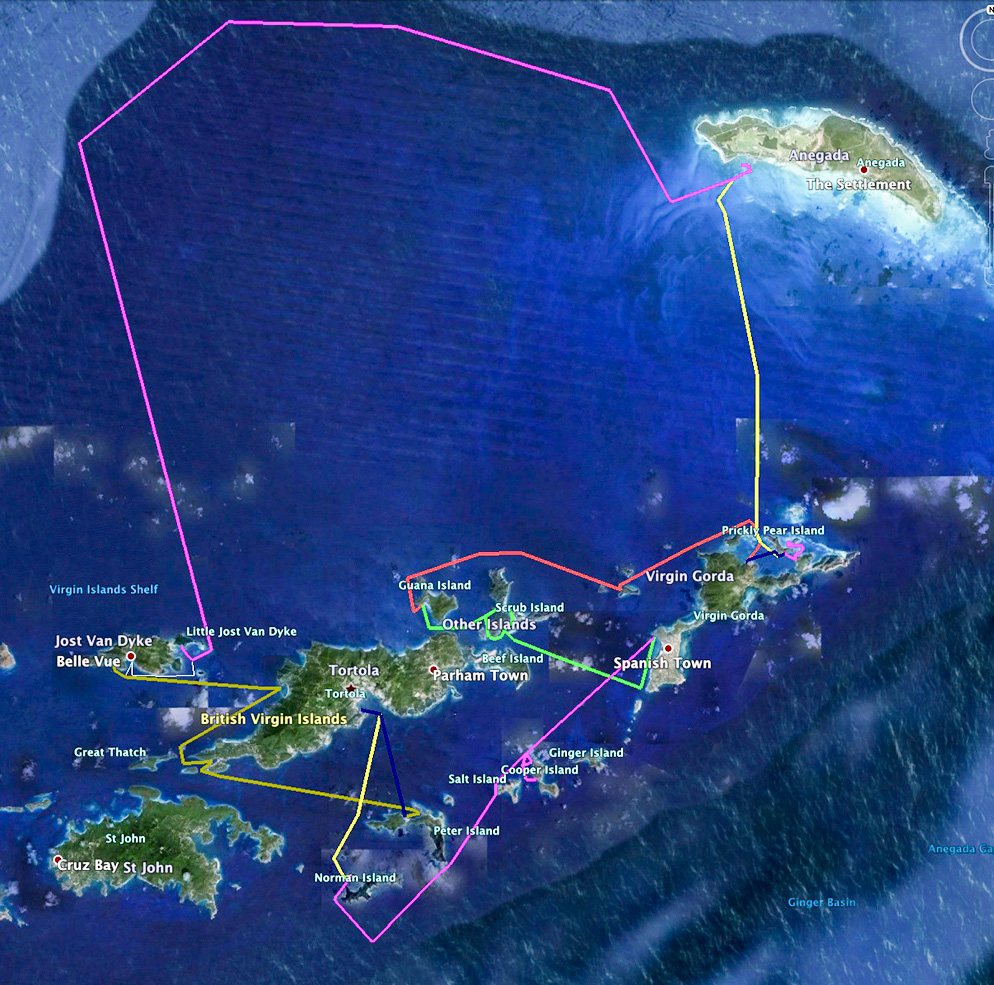
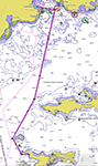
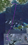
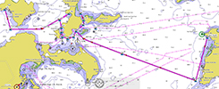
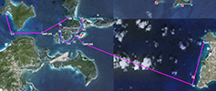
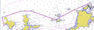
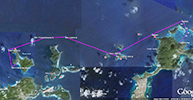
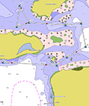
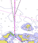
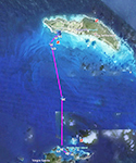
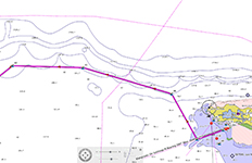
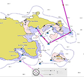
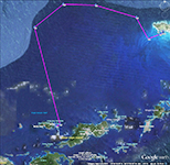
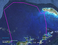
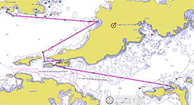
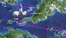
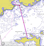
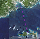
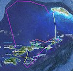 Click thumbnails above to expand the overall trip route and the color coded daily legs.
- ARRIVAL
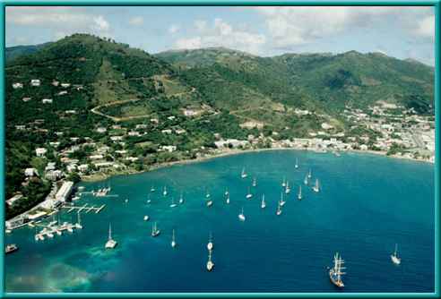
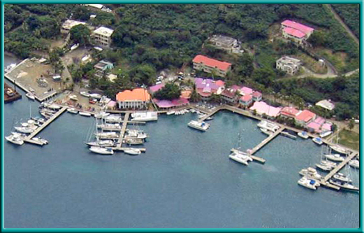
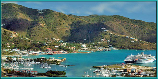
- The crew of the "Firefly" arrived at Conch Charters, Road Town, Tortola 4/7/13 for a sleep-aboard prior to departure on the 8th.
The Firefly is a Beneteau 403, a 40 foot monohull with a beam of 13 feet and draft of 5'1". Three double cabins, 3 showers including the transom, 2 heads, 764 sq. ft. sail area
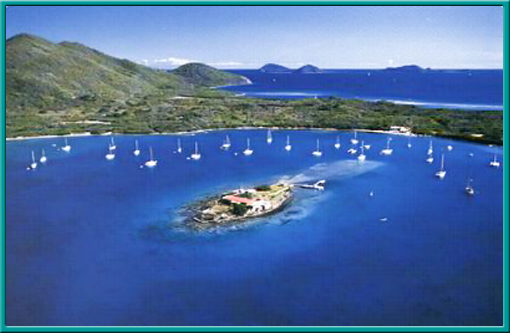
and all the other necessary electronics and conveniences. Check-in and skipper briefings were conducted the following morning and we set sail for Norman Island (Treasure Is.) via the "Indians" (National Marine Park) by early afternoon. We secured a mooring ball at Kelly's cove not far from the William Thornton and Pirate's Bight.
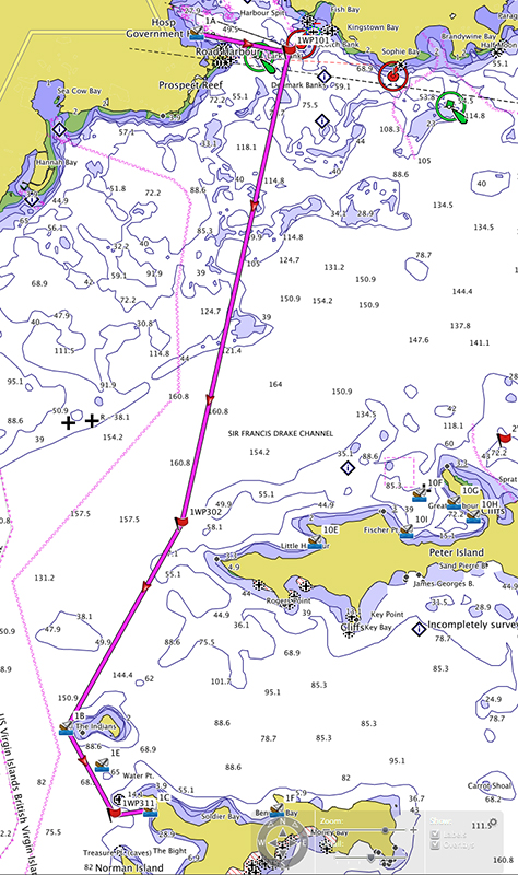
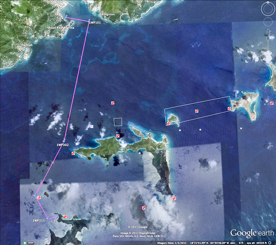
DAY 1
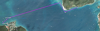
Road Harbour to Kelly's Cove, Norman Island
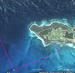
 Click thumbnails above to expand the "day 1" chart & satellite images.
- DAY 1 SLIDE SHOWS
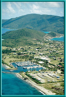
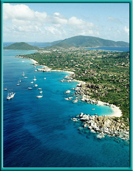
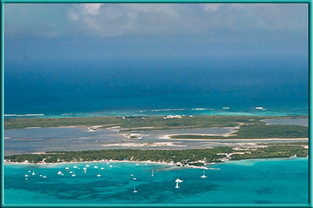
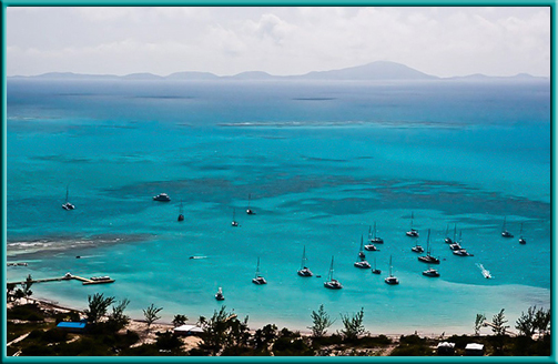
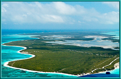
- The first day begins at Conch Charters Marina & Pub at Road Harbour, Tortola (above left aerial). There are views heading out the Sir Francis Drake Channel, and toward the National Underwater Park at Pelican Island, and Indians (above right aerial). The short second slide show has views of the first nights mooring at Kelly's Cove at Norman Island, and the raising of the BVI "No Quarter-Red" Skull & Bones.
 Click the "helm" for slide show 1
Click the "helm" for slide show 2
Click the "helm" for slide show 1
Click the "helm" for slide show 2
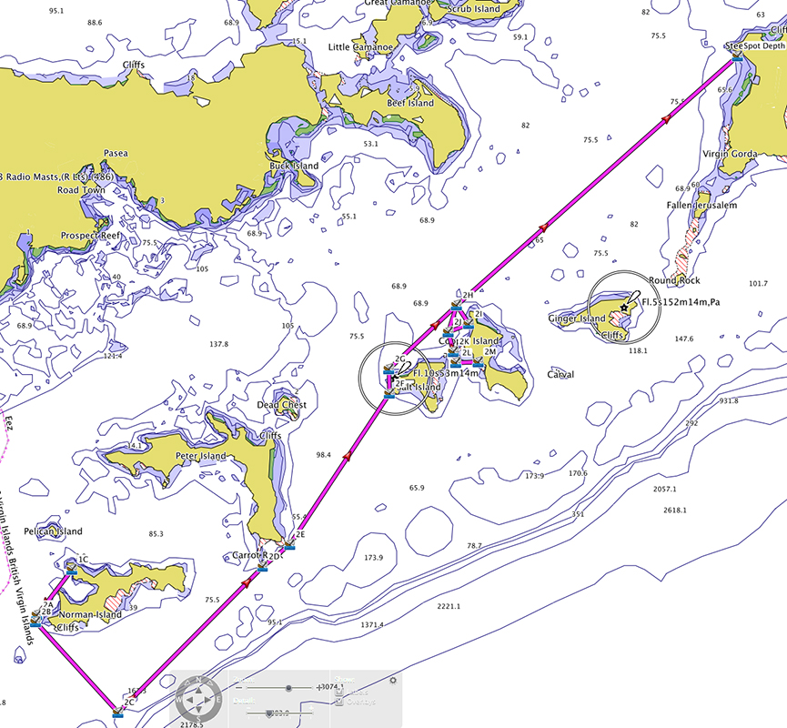
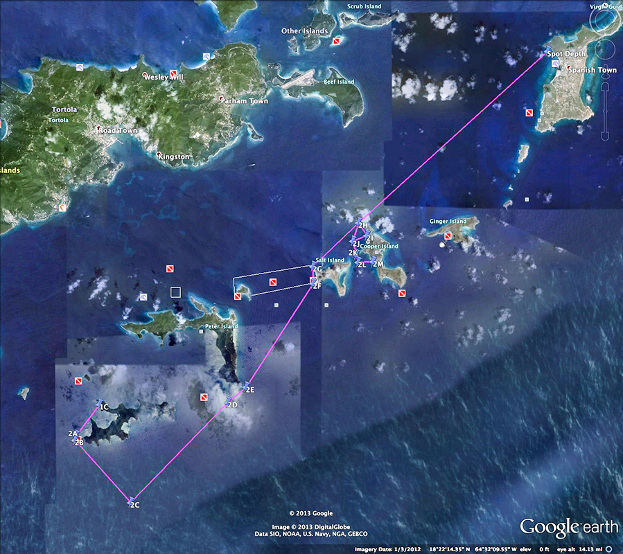
DAY 2
Norman Is. to Spanish Town, Virgin Gorda

 Click thumbnails above to expand the "day 2" chart & satellite images.
- DAY 2 SLIDE SHOW
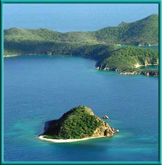
- Today started with snorkeling at the caves and rounding Carvel Rocks on Norman Island. We then headed to the South Drop to troll for fish before making way toward
Peter Island Bluff bringing us within viewable range of famous Dead Chest Island. We took a mooring off the west coast of Salt Island to dive the Wreck of the Rhone before
approaching Manchioneel Bay of Cooper Island. With no anchorage available at Manchionioneel, we slide between Cistern Point and Grouper's Nest to anchor off the white beach in Hallovers Bay, Cooper Island. Not enjoying the swells at Hallovers we back tracked to Quart-A-Nancy Point, Cooper and sailed to the anchorage just north and outside the Virgin
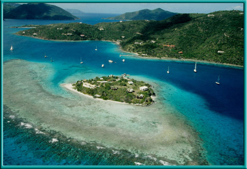
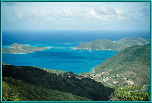
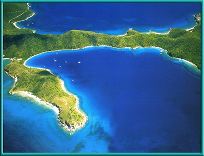
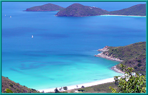
Gorda Yacht Harbour at Spanish Town (above left aerial). We arrived to a protected cove well inside Collision Point, anchoring in 15' of water in the lee of the headland about sunset, a long day indeed. Only a few pictures today, the caves and a fully rigged Tall Ship motoring down the Sir Francis Drake (SFD) Channel. The aerial pic on the right above is the SW coast, Baths-Devils Bay, of Virgin Gorda.
Click the "helm" for slide show 3
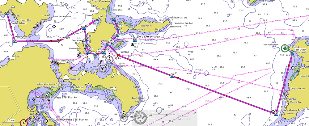
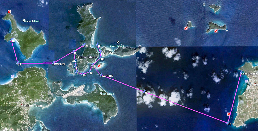
DAY 3
Virgin Gorda to White Bay, Guana Is.
 "Day 3" chart & satellite images.
- DAY 3 SLIDE SHOWS
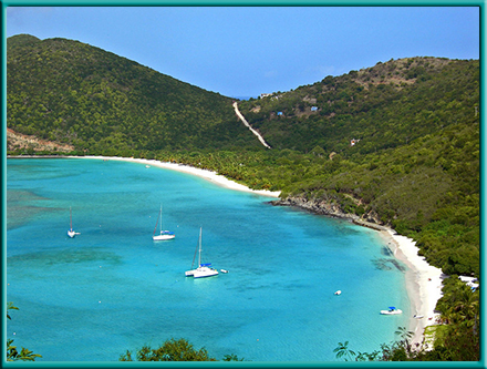
- Today, another long haul. A quick trip in the dinghy into Spanish Town, then to the Baths. Crossing the SFD Channel we're off to navigating the islands off eastern Tortola. We sail along Beef Island, past Marina Cay (above left aerial) to the east, with Great Camanoe to the west. Heading toward Cam Bay, we pass the Scrub Island Resort and Marina, finding Cam Bay unsuitable for an overnight anchorage today. We round the southern point of Great Camanoe and take Little Camanoe Passage toward Lee Bay where we anchor. Not satisfied at Lee Bay we lift anchor and set course for White Bay (above right aerial) on the west coast of Guana Island. En-route to White Bay we round Monkey Point, another underwater marine park. We drop the hook at White Bay enjoying the remainder of the day.
Slide show 4
Slide show 5
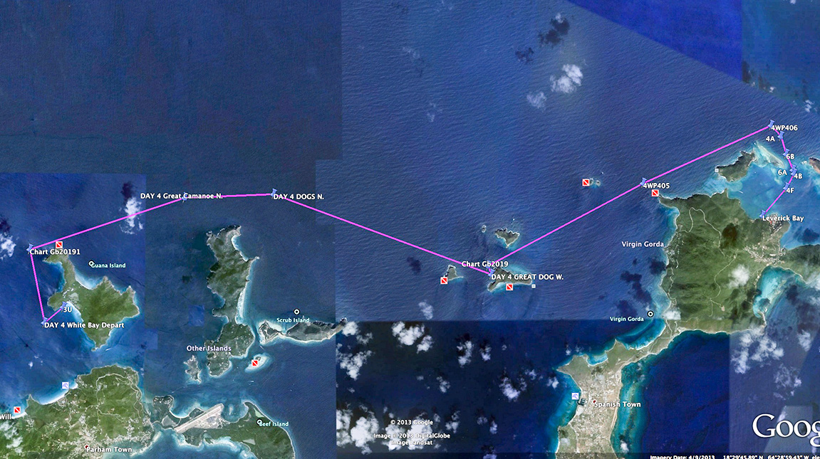
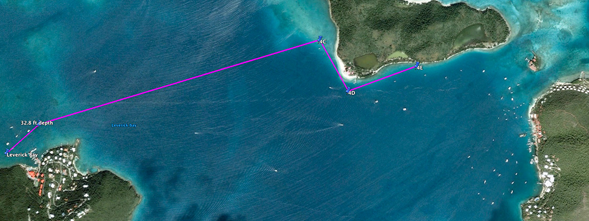
DAY 4
Guana Island to Leverick Bay, Virgin Gorda

 "Day 3" chart & satellite images.
- DAY 4 SLIDE SHOW
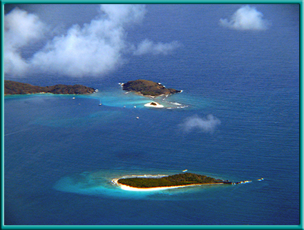
- We left the beautiful white sands of White Bay and sailed toward the "Dogs" (above left aerial) deciding to put in at the marine park on the western shore of Great Dog. After great snorkeling, we sailed between George and Great Dogs with a course NE between Mountain Point, Virgin Gorda and the Seal Dogs. We threaded our passage through the Colquhoun Reef (between Moskito & prickly Pear Islands)(yes, Moskito, not Mosquito) eyeing Drake's Anchorage on way to a mooring at Leverick Bay (above right aerial) for the night.
Slide show 6
DAY 5
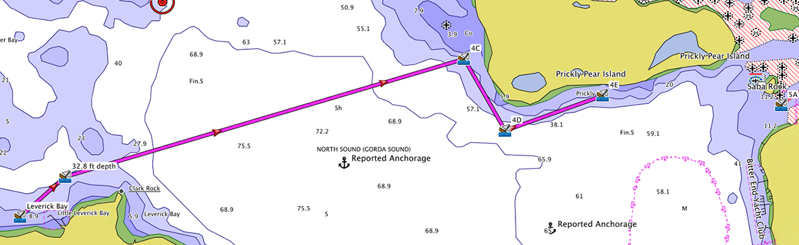
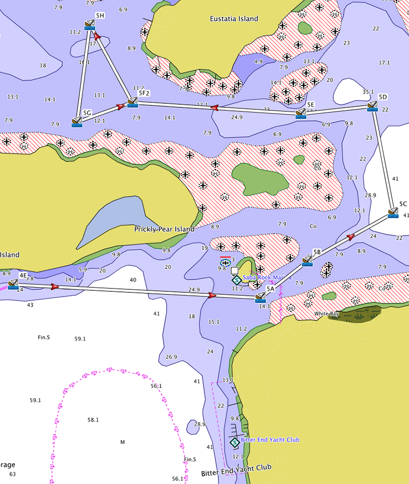
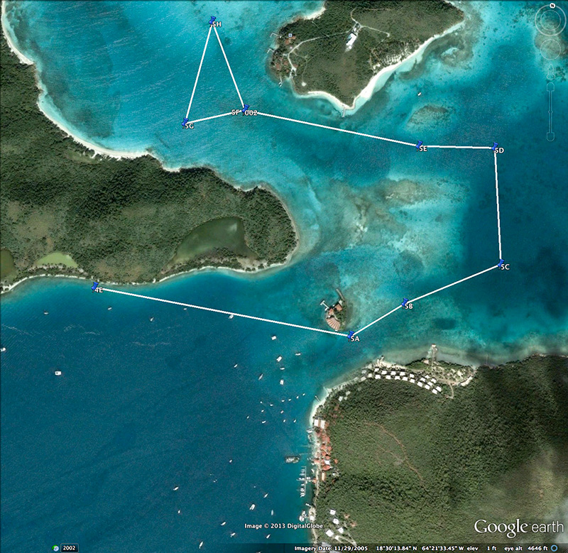
Virgin Gorda to Prickly Pear Island (Saba Rock)

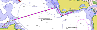
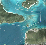 "Day 5" chart & satellite images (White routes are dinghy/snorkel sites).
- DAY 5 SLIDE SHOW
- Today is a free day for Firefly. First thing in the morning was to top off the tanks; fuel, a full 5 gallons, and much more water.
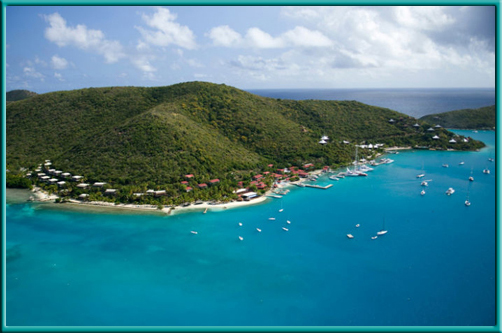
We then departed Leverick Bay Resort & Marina into the North Sound (Gorda Sound) sailing toward Vixen Point (Prickly Pear island above left aerial) in search of an anchorage for the day & some R & R. We took a mooring just east of Saba Rock along the shore of Prickly Pear, from this vantage point
we had close access to numerous points of interest. The dingy took us snorkeling into Eustatia Sound (see chart), as well as side trips to Saba Rock and the Bitter End Yacht Club (above right aerial). That evening was an unexpected but superb fireworks display probably originating from the new high end club, Yacht Club Costa Smeralda, in Biras Creek Bay. Not a big picture day.
Slide show 7
DAY 6
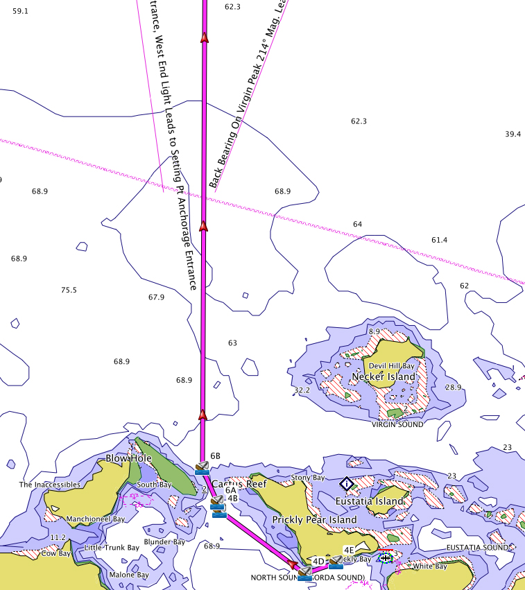
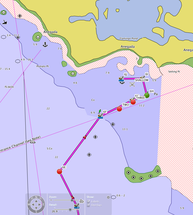
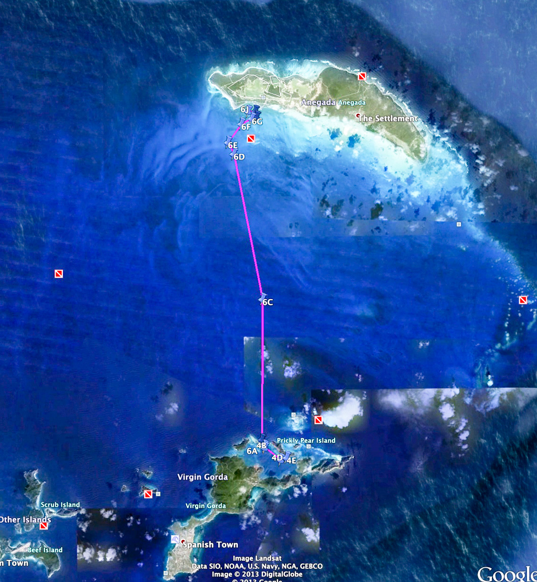
Prickly Pear to Setting Point, Anegada

 "Day 6" chart & satellite images.
- DAY 6 SLIDE SHOW
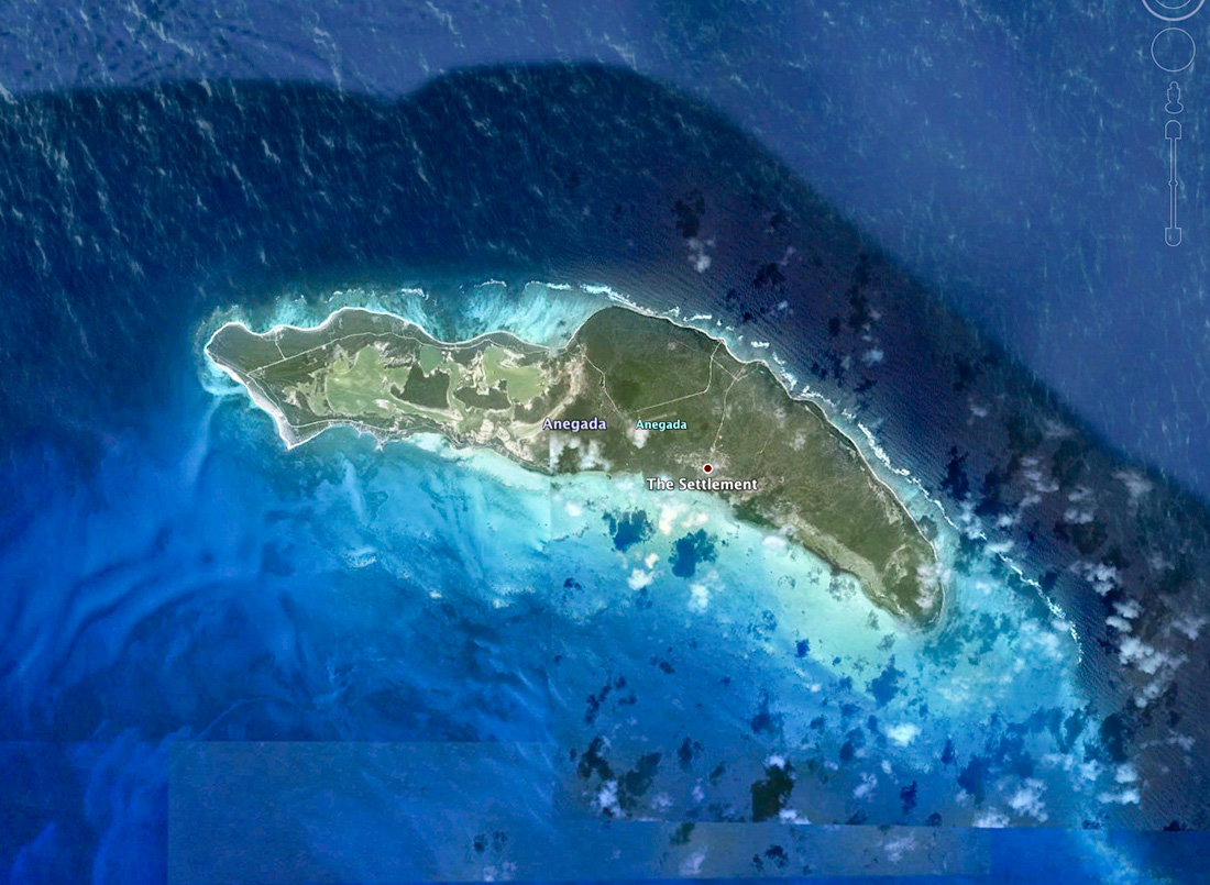
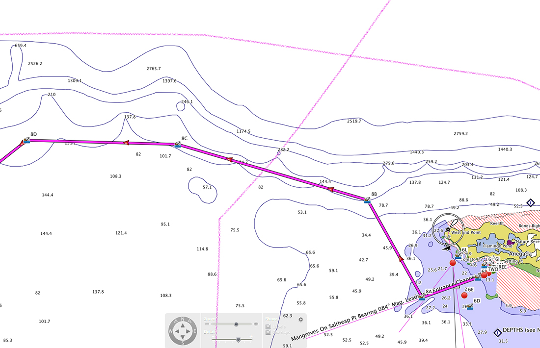
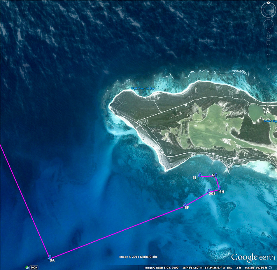
- Day 6 was spent in passage to Anegada Island, about 16 NM from our North Sound anchorage at Prickly Pear. Once underway, on course and the sails trimmed, we made good time averaging 7 knots. We held a single tack the entire trip. After navigating the channel between Setting Point and Jake's Reef we took a mooring ball for two nights. We went ashore rented a car for the stay and drove off to nearby Cow Wreck Beach for the remainder of the day. Above left aerial is the Colquhoun Reef (entrance/exit to the North Sound), the right aerial is Setting Harbour, Anegada.
Slide show 8
DAY 7
A FULL DAY on ANEGADA
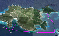
 "Day 7" Island map & satellite images.
- DAY 7 SLIDE SHOWS
- Having overnighted in the harbor at Setting Point, Anegada, we packed our gear and used the dock of "Potters By The Sea" to begin our exploration of the island today. We accessed our rental car nearby and drove to the finest snorkeling beaches in the Caribbean. The first stop was the bright island pink colors of "Flash of Beauty" on Loblolly Bay, from there it was on to"Big Bamboo" on Jack Bay. Pictures of Jack Bay fill all of the 2nd slide show, and finish at the beginning of the 3rd. With a classic Caribbean sunset, we had our farewell dinner at "Neptune's Treasure" back near Setting Point at the harbor.
Slide show 9 Slide show 10 Slide show 11
DAY 8
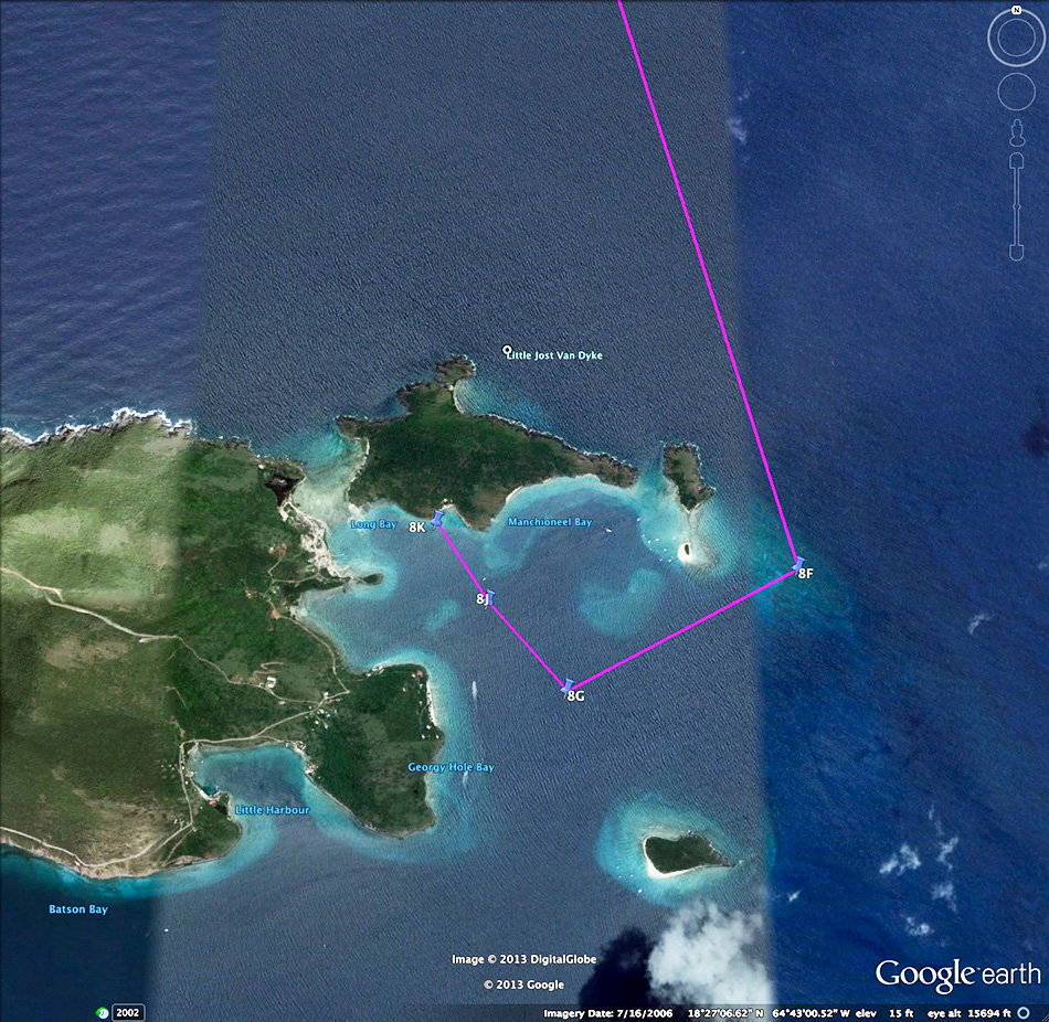
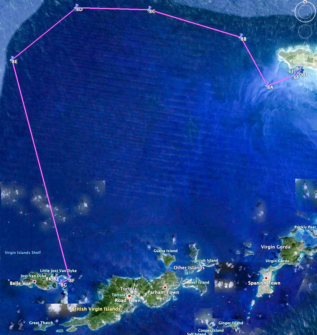
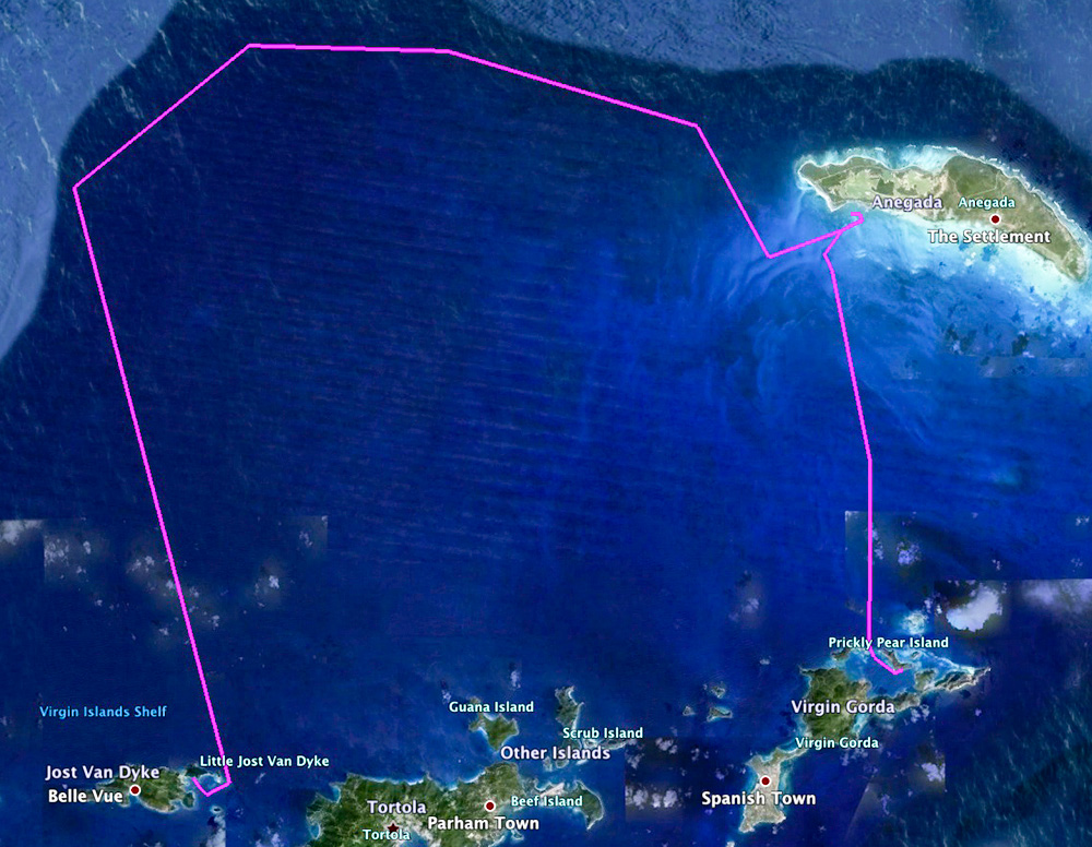
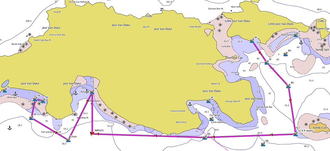
Anegada to Manchioneel Bay, Little Jost Van Dyke

 "Day 8" chart & satellite images
- DAY 8 SLIDE SHOW
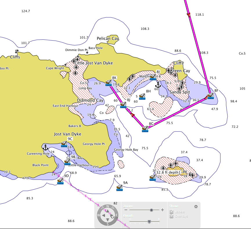
- We departed Anegada early today to sail and fish (trolling) a large loop which followed the North Drop ( a ~2700 foot shelf to the ocean floor). We put a single reef in the main and trimmed-up the genoa, keeping our speed down in an effort to drive the lures deeper. Our destination was Little Jost Van Dyke, where we dropped the hook in 15 feet of water in a small cove just west of Manchioneel Bay. We decided to retire the fishing poles. Snorkeled here at the anchorage and visited Foxy's Taboo. The above left aerial shows partial Little JVD, Green Cay, Sandy Spit, and Sandy Cay at the foot of the picture. The right aerial is tomorrows anchorage at White Bay, JVD.
Slide show 12
DAY 9
Little Jost Van Dyke to White Bay, JVD

 "Day 9" chart & satellite images
- DAY 9 SLIDE SHOWS
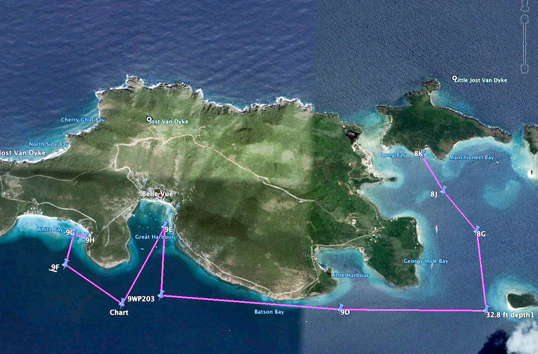
- First stop today was Sandy Cay (above left aerial) for snorkeling and a walk through the trails of the nature preserve. Then passing Little Harbour we sailed on to Great Harbour (above right aerial) to chat with Foxy himself, picked up ice and sailed to our afternoon anchorage at White Bay, JVD. A cruise ship had sent boats of tourists to all the beaches on JVD, there were people at all the hot spots. We took a mooring ball at the east end of White Bay and went ashore. The 2nd slide show has many of the popular beach bars; Soggy Dollar, Corsair's, One Love, to name a few. The 3rd slide show is mostly Ivan's Stress Free Bar, a lot to look at there.
Slide show 13 Slide show 14 Slide show 15
DAY 10
JVD to Tortola and Great Harbour, Peter Island

 "Day 10" Chart & satellite images.
- DAY 10 SLIDE SHOW
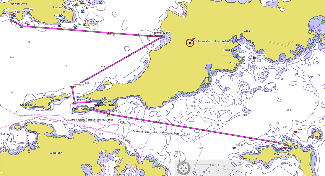
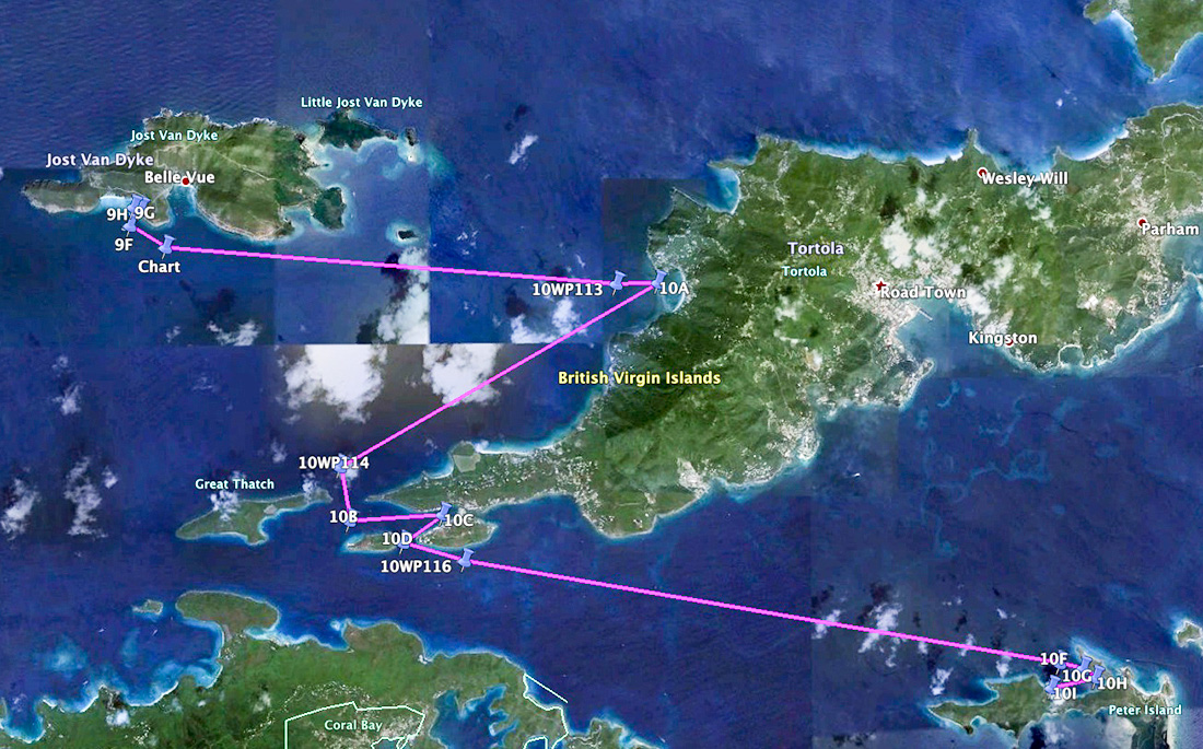
- Our last full day to sail. We left early and sailed to Cane Garden Bay, west Tortola. We decided not to go ashore and made a pass through the bay following the coast line toward Great Thatch island. See aerial view of Cane Garden (left pic above). We sailed into Thatch Island Cut, rounding the west point of Tortola and moored for lunch at Soper's Hole (above right aerial). Winds were picking up and coming straight down the SFD Channel. The sails were reefed and we headed for Buttonwood Bay in Great Harbour, Peter Island. We took a mooring ball at Oceans Seven restaurant & bar and found ourselves their only patrons. From our mooring we could see across the SFD Channel into Road Harbor, where we return in the morning.
Slide show 16
DAY 11
Peter Island to Conch Charters, Road Harbour, Tortola
 "Day 11" Chart & satellite images.
- DAY 11 SLIDE SHOWS
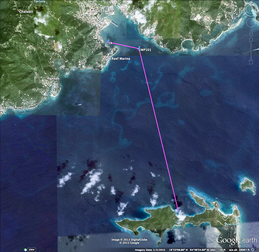
- A single destination today, Conch Charter's marina. Above left aerial is Great Harbour at Peter Island, and the right aerial is Road Harbor. I have a picture of a very nice little ketch anchored nearby (anyone know what it is?), then it was off across the SFD Channel for the final time. It was a good blow across the beam. Back at the docks it was farewell. Bill & Pat left for St. Thomas, while Patti & I spent the afternoon at the Tamarind Club at Josiah's Bay, on the north east coast of Tortola. It was a beautiful bay with large breakers rolling in, a local surfers hangout.
Slide show 17
Slide show 18
DAY 12
Josiah's Bay to (EIS) Beef Island Airport via taxi
- DAY 12 SLIDE SHOW
- The Trellis Bay/Beef Island Airport is within walking distance of the beach bar restaurants at Trellis Bay. The village was like a ghost town, but once a month is the Fire Ball Full Moon Party and it's a zoo. The left aerial is Josiah's Bay and right is Trellis Bay.
Slide show 19

Date Last Modified: 08/20/2013
Copyright © 2013 Axoplasmic.com All rights reserved. Web Site Designed and Maintained by